WALKS & INTERESTING PLACES
Listed North to South
DINAS ISLAND
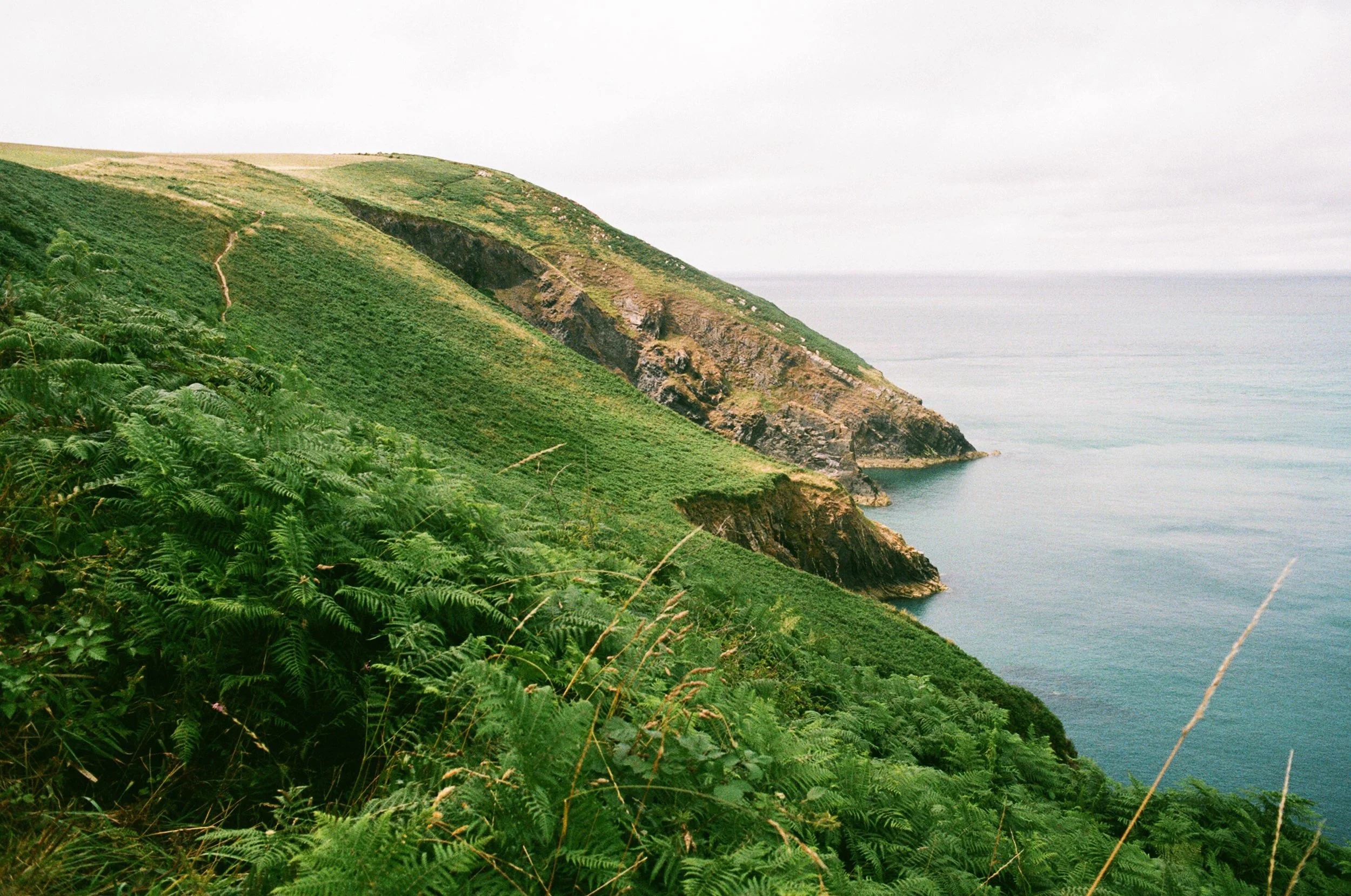
This is a lovely 2-hour circular walk that’s around 3½ miles in distance. You start at Pwllgwaelod after negotiating long sections of narrow lanes that make their way down to this tiny hamlet. There is a beach and old pub here called The Old Sailors where we parked up. The walk takes you around a promontory partially detached from the mainland called Dinas Head, and on to the pretty village of Cwm-Yr-Eglwys.

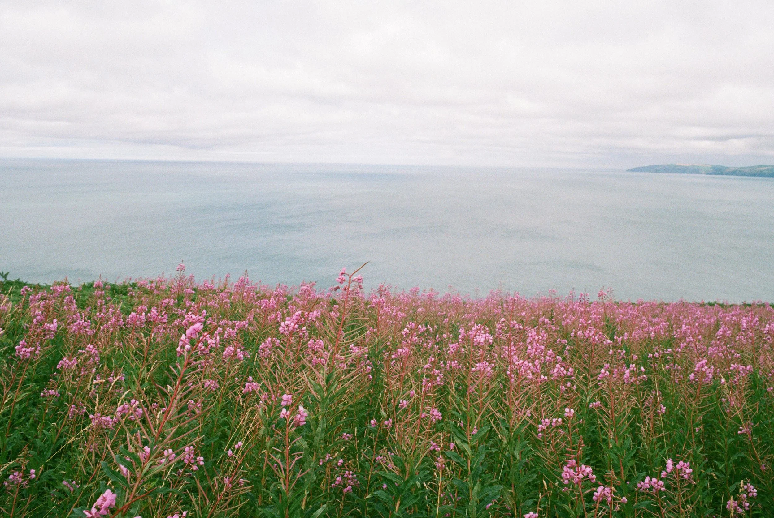
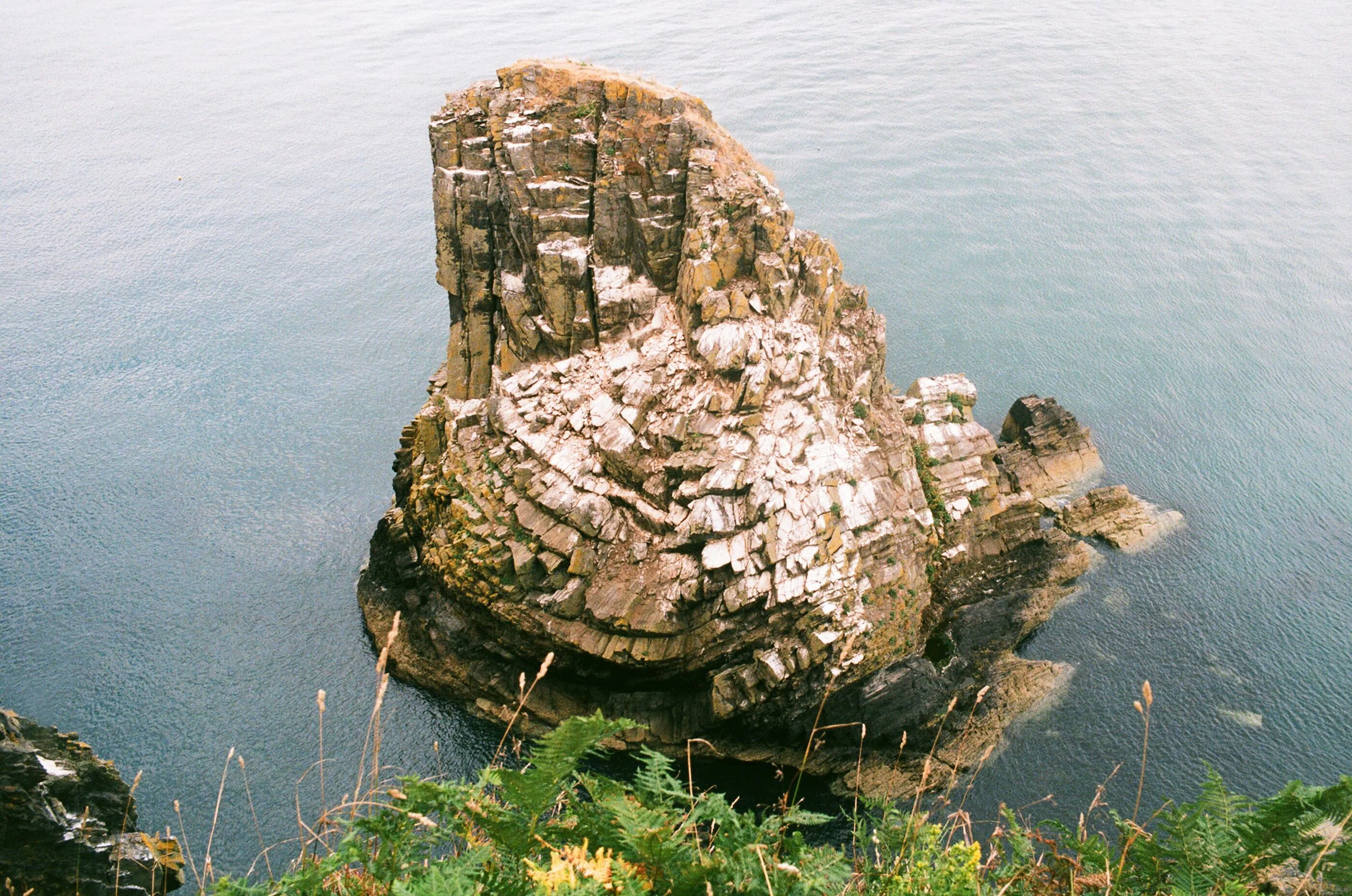
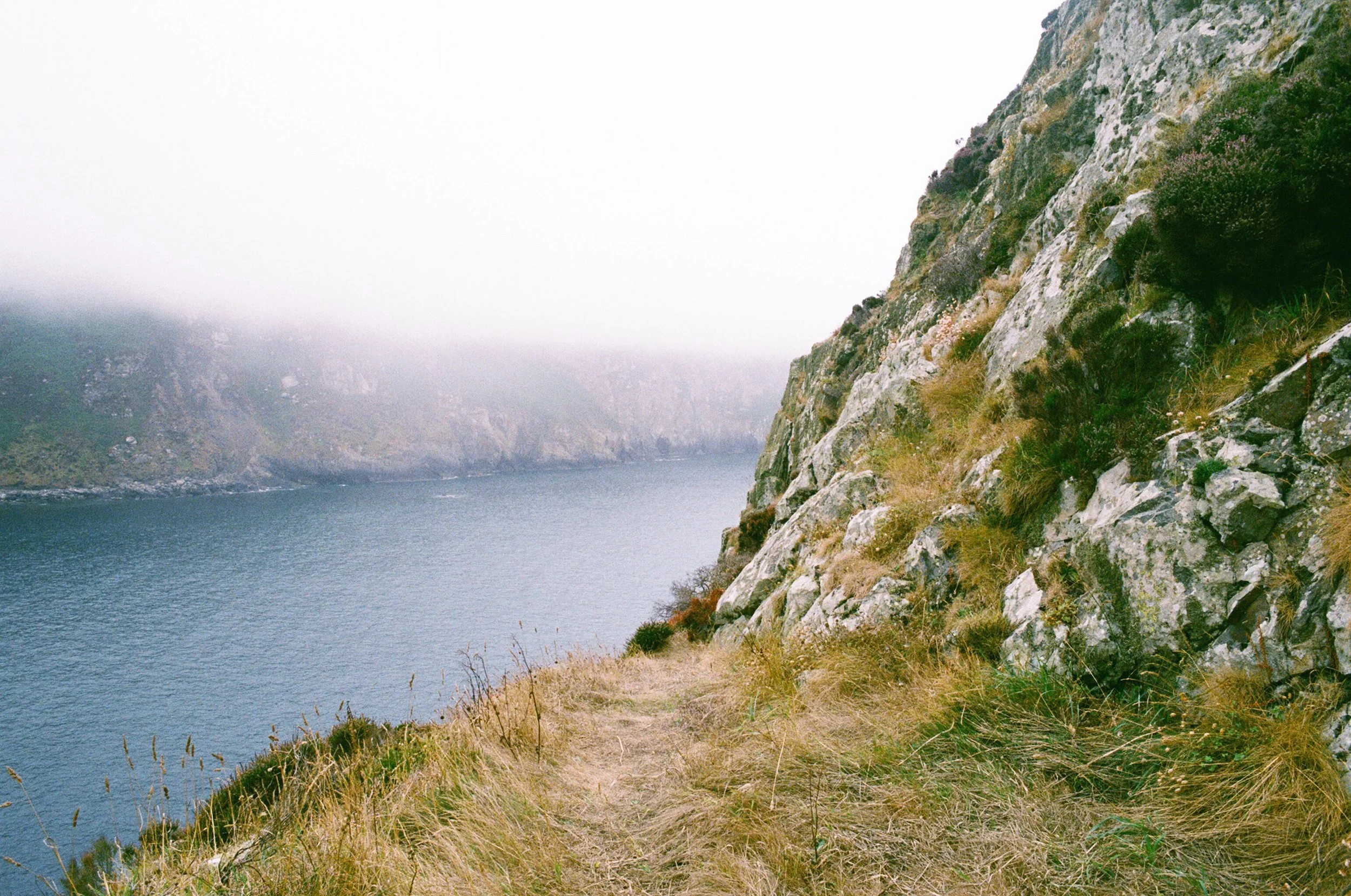
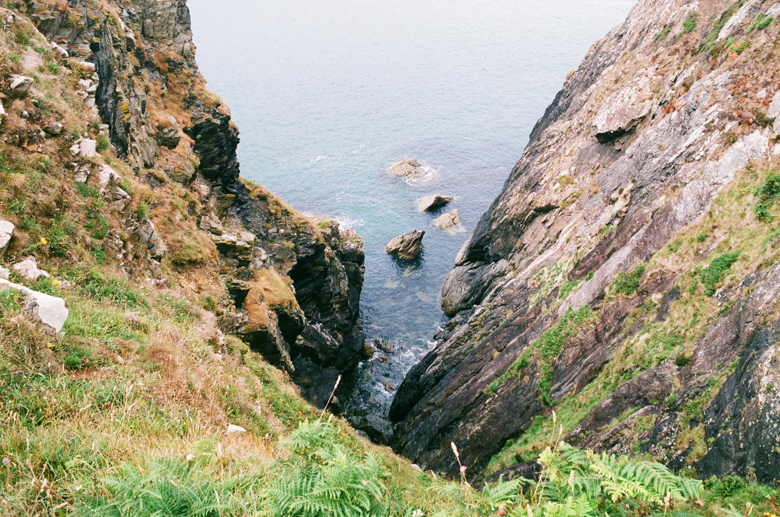
There are steep ascents and descents on route but you are rewarded with great views, especially from the highest point at Pen-y-Fan, 465 feet above sea level. These include views across Newport Sands, Fishguard Bay and inland to the Preselis. Butterflies and the unmistakable sound of crickets in the undergrowth accompanied us along the way. We passed through vibrant green ferns, wind-pruned trees, bracken and bramble, purple heather shoots, yellow gorse and lots of different coastal wild flowers. At a section the path splits and we took the track closest to the edge, snaking around the coast. This route gives you a good look at a large tooth-shaped stack jutting out from the sea called Needle Rock and the various breeding colonies of seabirds that call it home in summer.
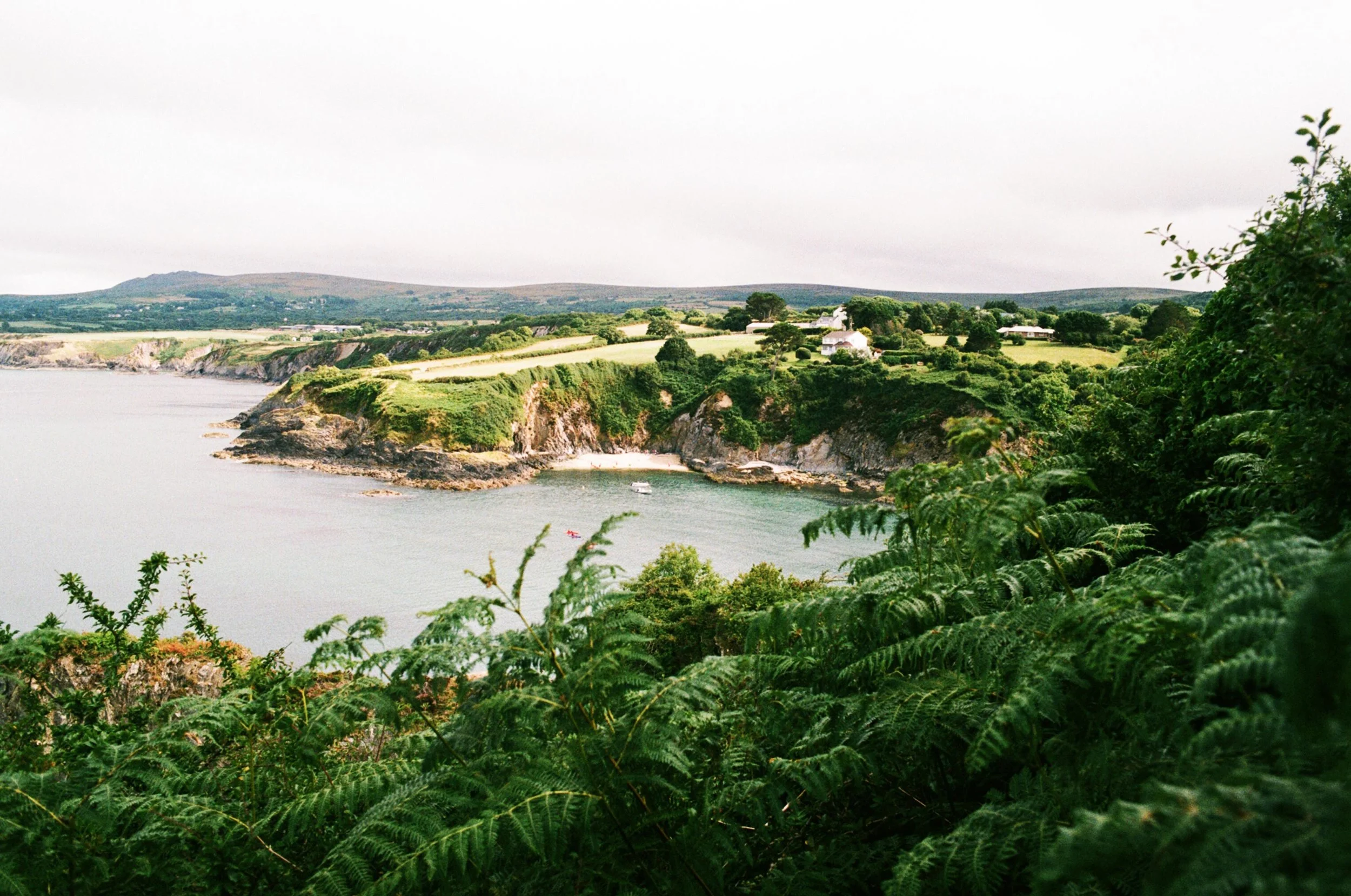
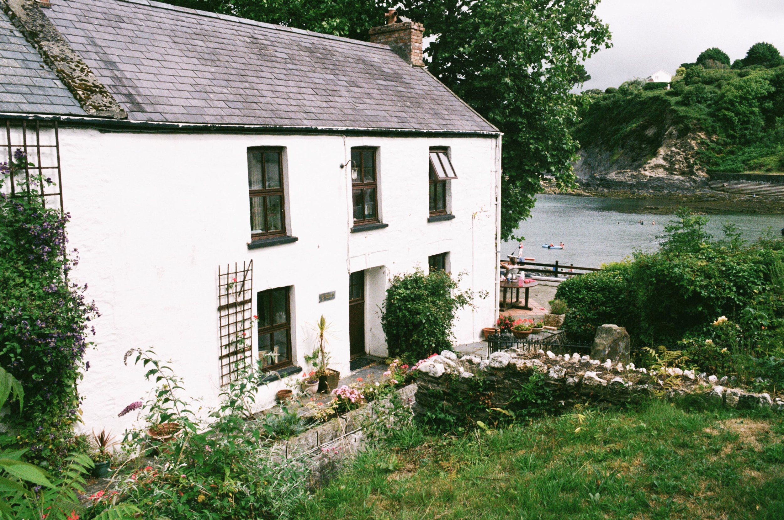
Onwards the bay at Cwm-yr-Eglwys eventually comes into view, a lively sandy little cove with a stream running through the middle and a narrow slipway for launching boats. There are also two small low tide coves either side, which looked accessible via a scramble over the rocks. You walk round the back of a row of pretty old cottages that have the most incredible outlook over the bay. From here the picturesque hamlet opens up, framed by lush trees and bright flowers thanks to its microclimate.
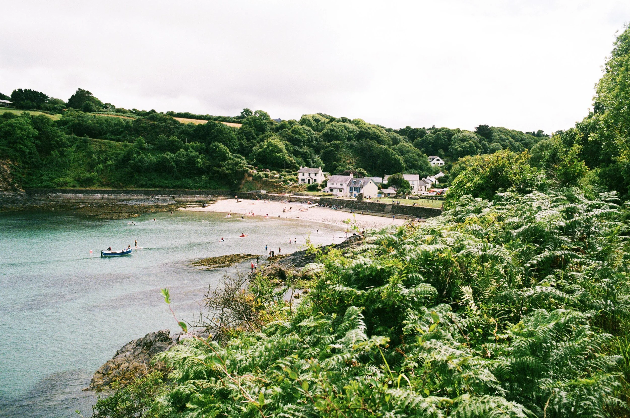
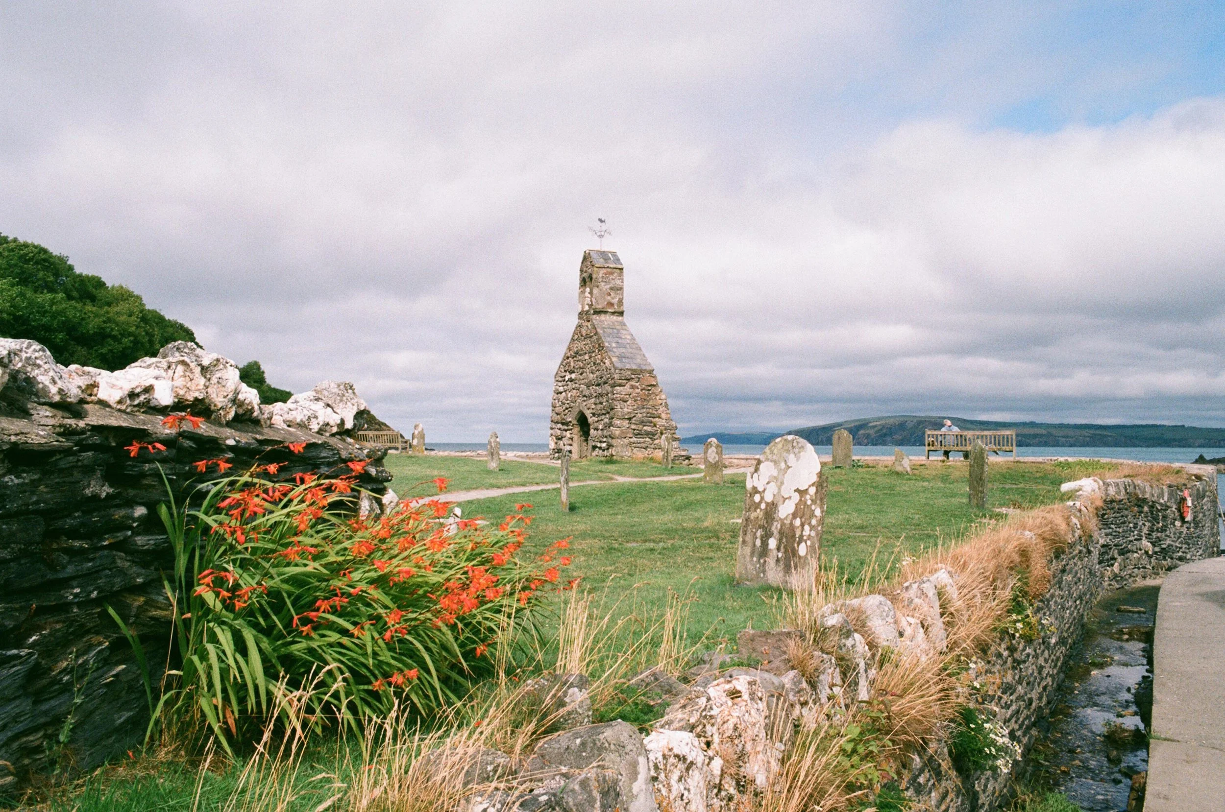
Overlooking the bay are the remains of the 12th century St Brynach’s Church and graveyard. On 25th October 1859 a great storm destroyed the church along with 114 ships out at sea. Before the construction of the sea wall, bones and coffins were often exposed here by wild waves when the beach level was much higher. Another storm hit in 1979 destroying more of the church, and now its ruins make for a romantic backdrop to the beach. We had ice creams from a stand in the small public car park and sat on what’s left of the church wall, watching an old man paint the view ahead of us.
The return to Pwllgwaelod runs along a mile-long glacial valley that separates Dinas Head from the mainland. It’s a flat, straightforward footpath and mostly shaded by dense trees, a haven for wildlife. Look out for a hidden rope swing about half way.
Back at The Old Sailors we settled in the beer garden for a drink. This is a perfect walk to sample the simple pleasure of a wander around this beautiful coastline, where you can start and finish at an old pub looking out to sea.
GARN FAWR TO PWLL DERI
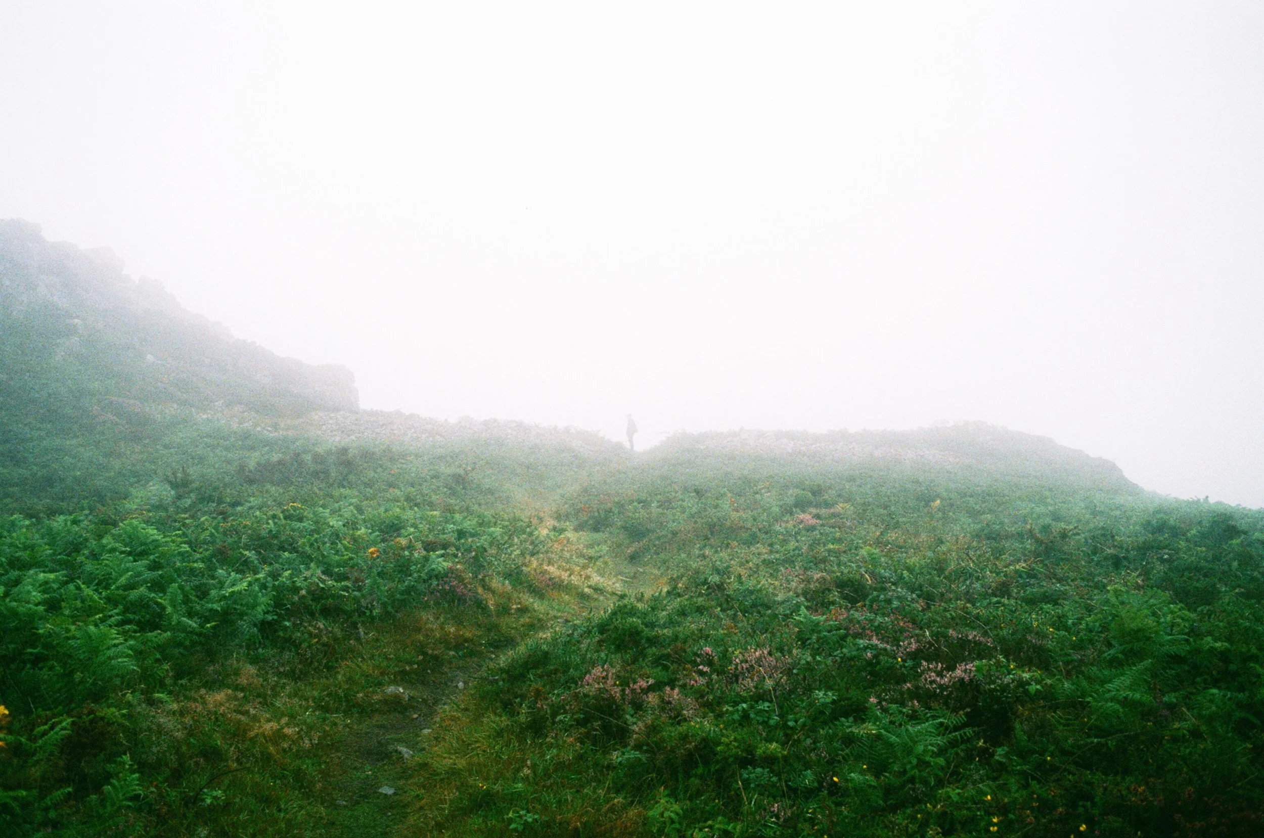
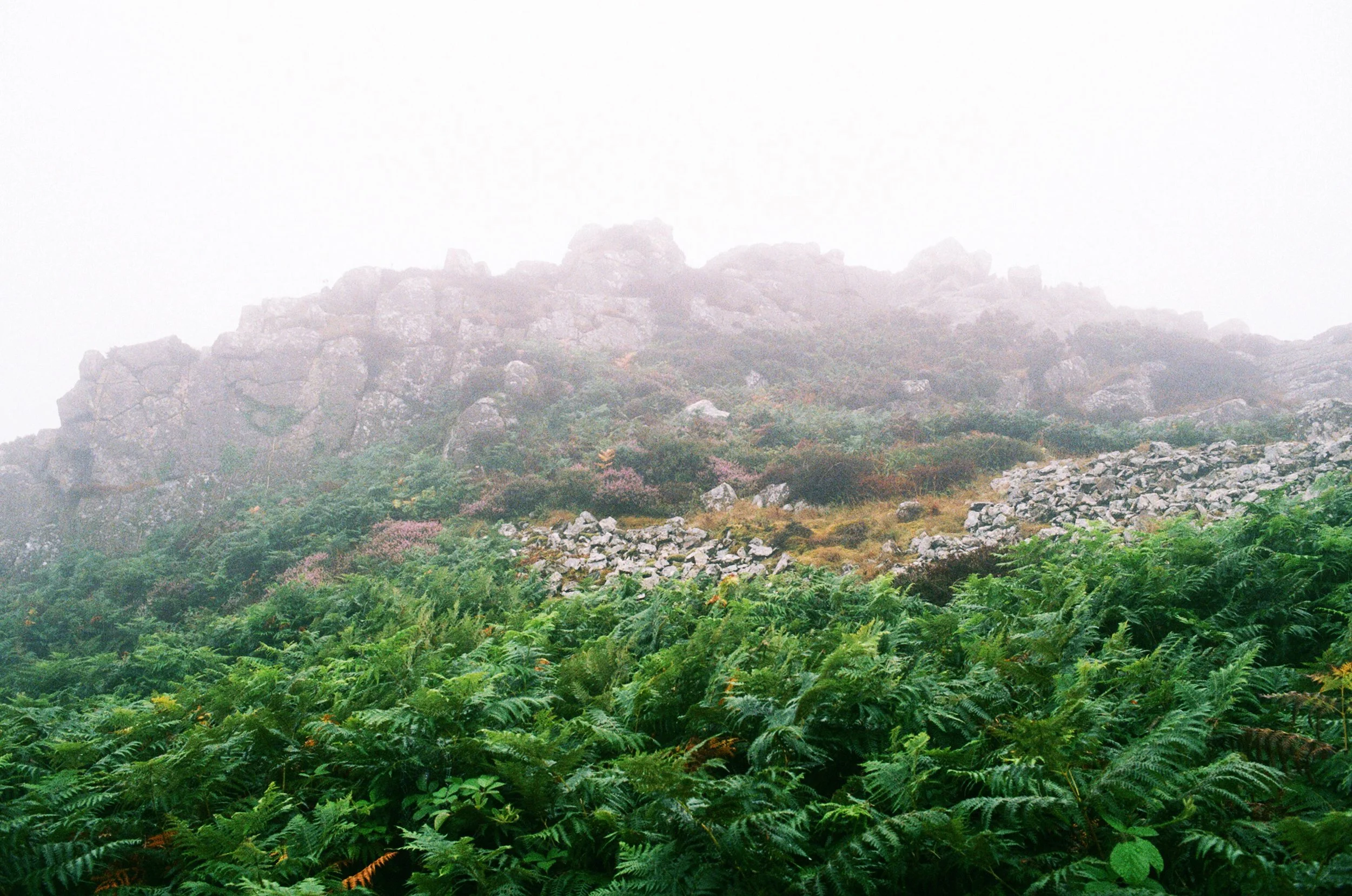
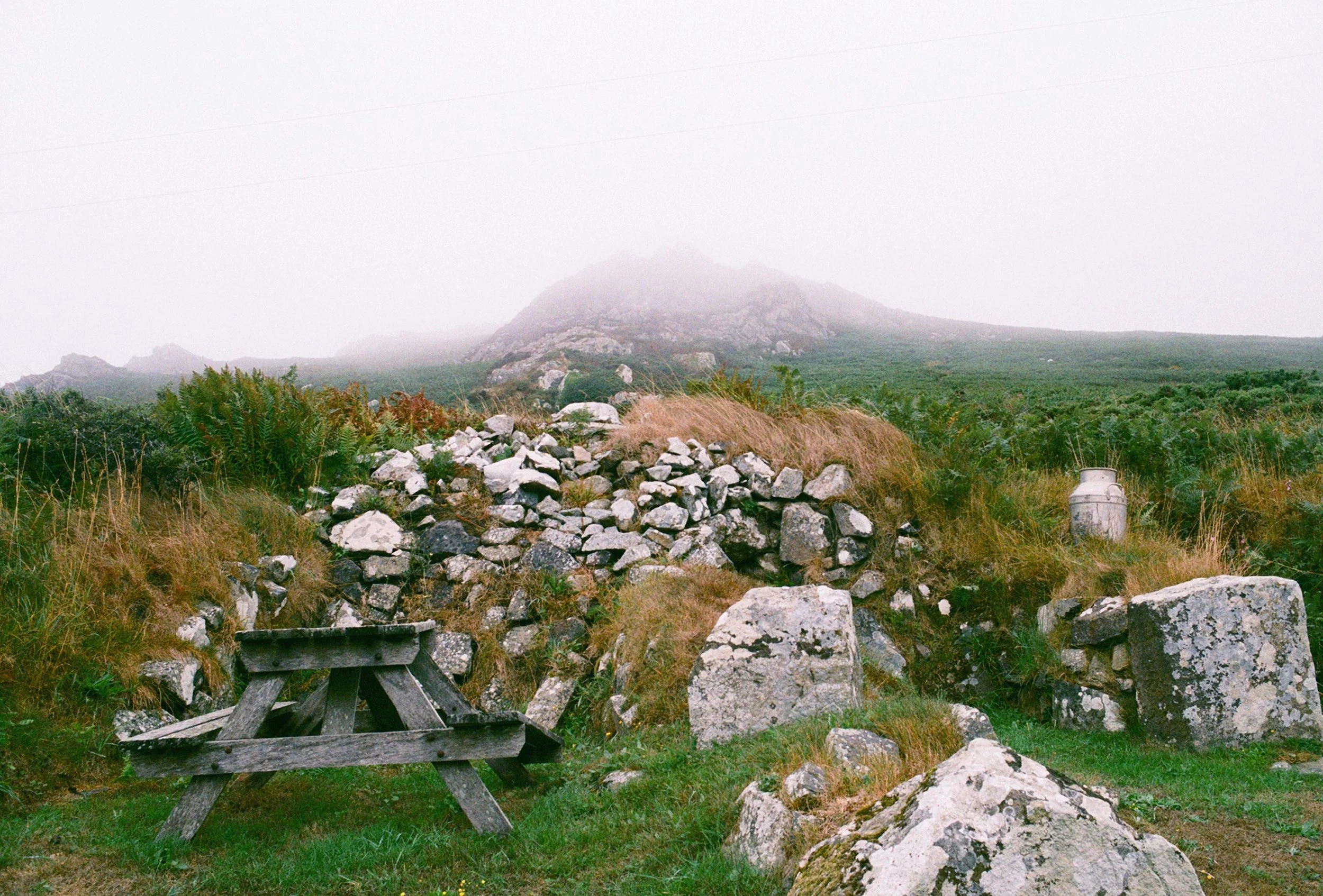
From the Hillfort Campsite there is an easy to access path for beautiful walks that take you scrambling up the volcanic summit of Garn Fawr, cutting through a carpet of ferns and wild flowers. Despite the low hanging clouds and cocoon of thick mist at the top that day, the rock formations were beautiful. All around you are banks and ramparts of the Iron Age fort that are fascinating to map out. It felt dream-like up there hemmed in by the fog and looking out through the haze. On a clear day I imagine the panoramic views to be breathtaking. Continuing down a steep rocky path on the other side of the summit, you end up at a gap in a stone wall. From here a grassy path leads on, passing a small car park. There is a circular walk up and around Garn Fawr from this point; an alternative if you weren’t starting at the campsite.

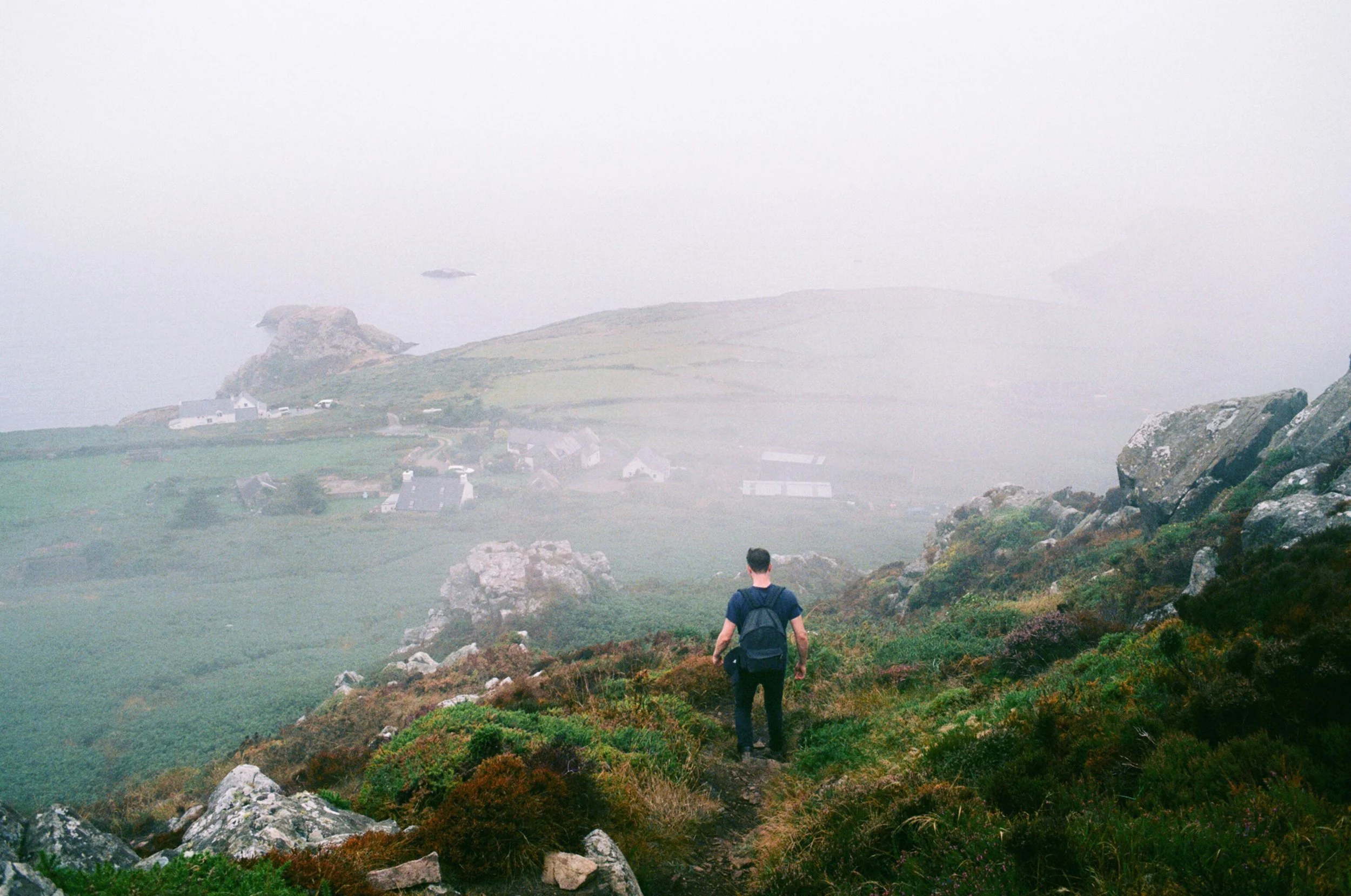
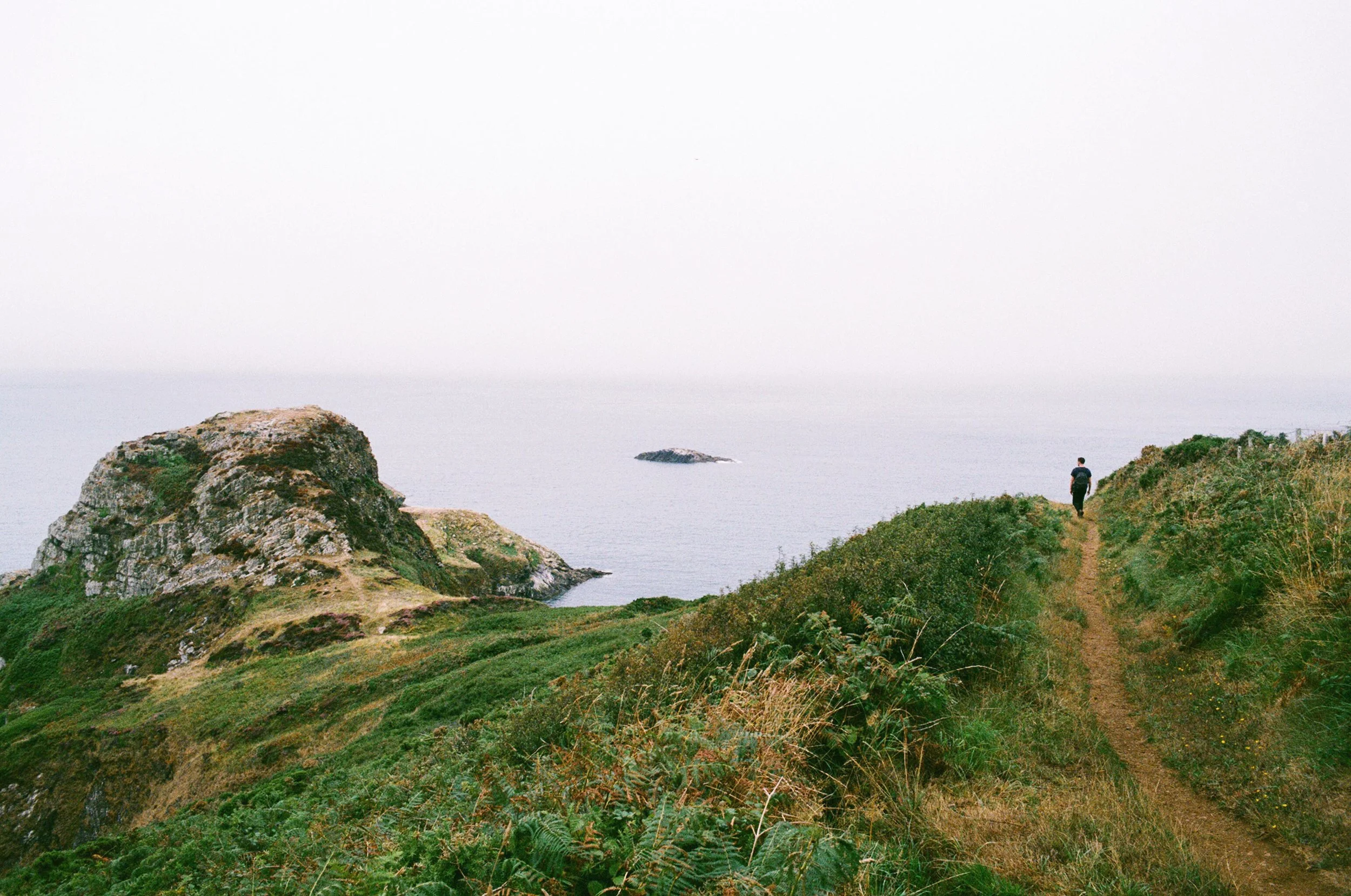
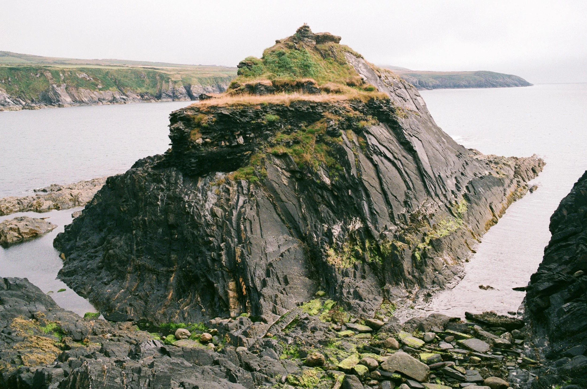
We headed towards Pwll Deri where you pass through a small hamlet of pretty cottages and the Pwll Deri Youth Hostel, a white washed old building perched on top of 400ft cliffs. The coastal path then leads down to the ancient promontory fort of Dinas Mawr. Here a small Iron Age structure would have sat on a towering pinnacle of rock, connected to the mainland by a craggy neck. It is thought that there was some ritual or ceremonial use for the fort, and with it being in this liminal space between land and sea, the atmosphere certainly suggests so. It is a dramatic spot to watch the sea mist roll in, with rocky ledges below and a hidden ladder that leads to swimming in deep water and caves. We spotted a seal in the cove and were told by a passer by that seals use the small shingle areas for pupping in the autumn. Sightings of porpoises and bottlenose dolphins also aren’t uncommon.
We retraced our steps back to the campsite from here. Next time I would love to continue on to Porth Maenmelyn where I’ve read about the remains of a Victorian flight of steps cut into the cliffs, still navigable to access the beach with the aid of a rope.
ABERREIDY TO PORTHGAIN
This is a short walk (around 1.5 hours) and covers a stretch of coast that really highlights Pembrokeshire's industrial past, now reclaimed by nature after a century of weathering. The walk can alternatively be done in reverse and parking is available either end.
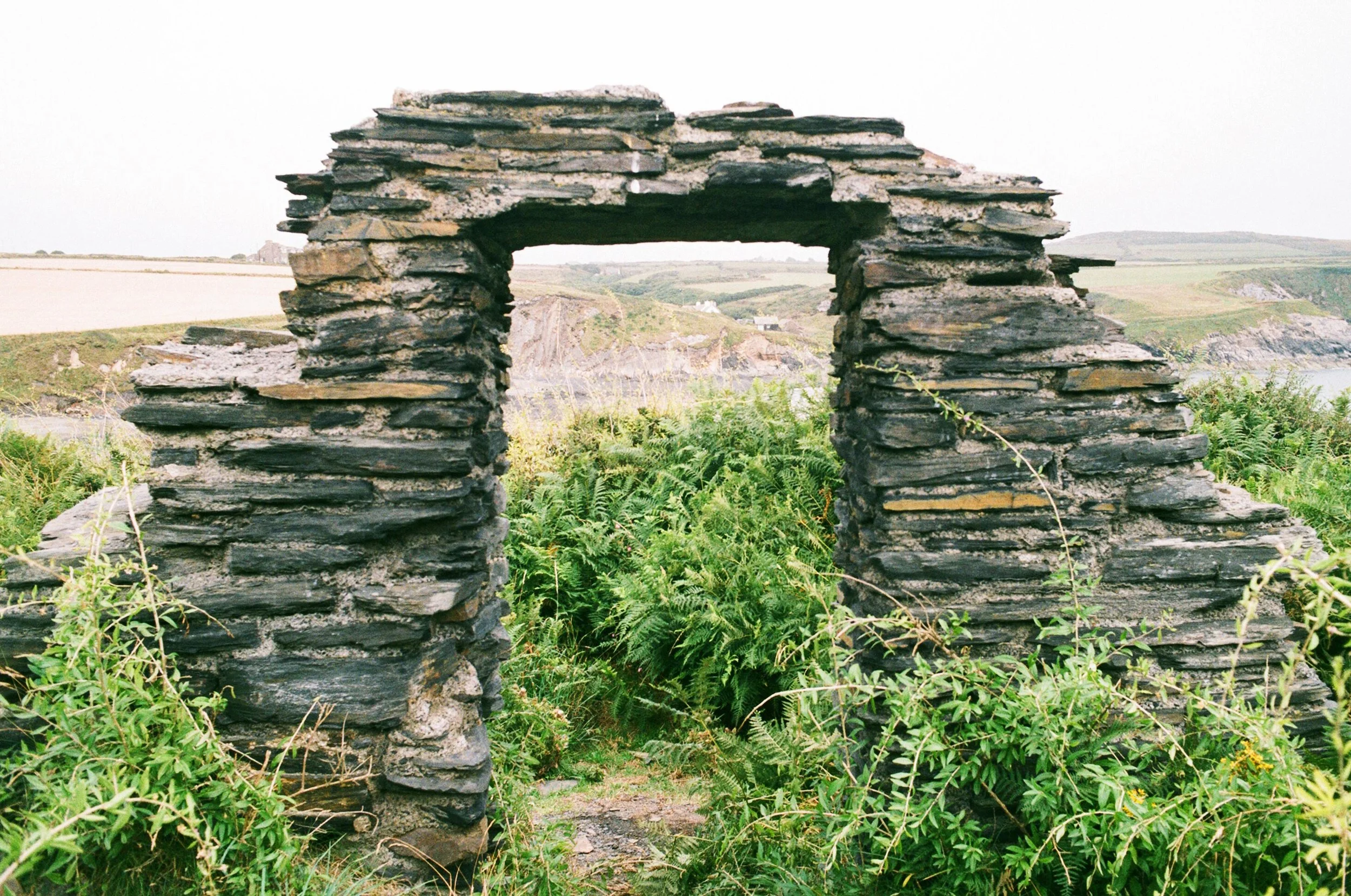
We started at Aberreidy beach, which is worth exploring and good for fossil hunting along the foreshore to the left of the bay. To the northern end of the car park you head up the cliff and along the coastal path, passing ruined quarry worker cottages. This local industry kept a small hamlet here employed but sadly a bad storm in 1904 forced its occupants to leave. Taking a left at the first finger point you can explore Pembrokeshire’s famous old slate quarry, the Blue Lagoon. I would say that a swim here is an absolute must.
After a good swim, we continued on the coast path along a section of high cliffs with rugged volcanic peaks until we reached relatively flat terrain along the top. Onwards, the secluded bay of Traeth Llyfn comes into view at low tide, hugging the cliff-base below. It can be accessed via a metal staircase and is worth heading down to.
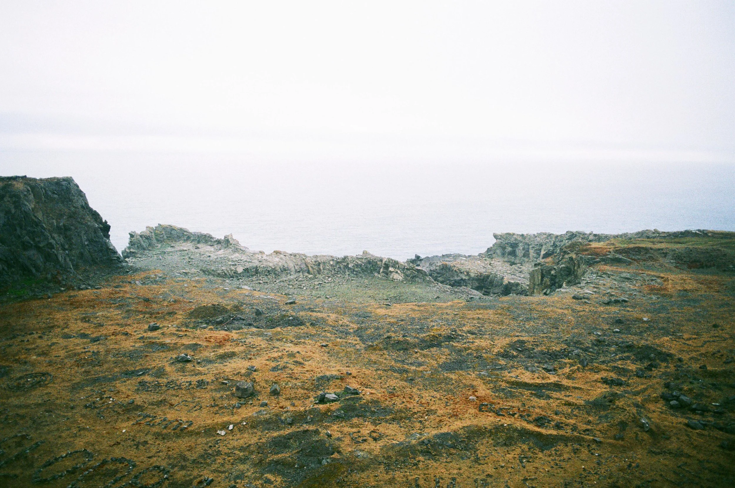
A little further brings you to the Penclegyr headland and the disused stone quarry. Here there is a real otherworldly feel when you approach. Visitors have created large patterns by arranging stones across the ledges, marking their passing by drawing names, dates and shapes with the rocks. The ruins are separated from the coastal path by a deep ditch that was once the route of a tramway, used to move granite from the stone-workings in the sea cliffs below. A few buildings remain that can be explored, and another impressive quarry sits at the end of the tramway after taking a slight detour off the coast path to the right. Underneath your feet here are a network of disused tunnels.
As we approached Porthgain, we spotted tall cone shaped structures on the cliffs at either side of the channel. These would have been used to guide boats into the harbour entrance. Porthgain is a pretty and narrow fishing port where bricks were made until 1912 and granite road stone exported in boats across the UK until the 1930s. The coastal path leads you down concrete steps and past a white-washed old building before reaching the quayside. Large seaward walls protect the harbour and huge red-brick hoppers provide a dramatic backdrop to it along the west cliff. Granite road stone would have been crushed and stored in them, but these listed buildings now serve as net stores for the remaining local fishermen.
Having passed the harbour you find yourself in the village, a perfect place to stop for lunch or dinner. On the quayside, converted from a former industrial building, there is a great little bistro called The Shed. Across the green there is also the historic Sloop Inn. You can either then walk to Aberreidy back along the coast as we did, or take a circular route inland. If you are not up for the walk, the Strumble Shuttle coastal bus runs between Porthgain and Abereiddy but check the bus times ahead.
FLIMSTON CHAPEL, THE GREEN BRIDGE OF WALEs & ELEGUG STACKS
On the south coast of Pembrokeshire, the Green Bridge of Wales is a well known natural rock arch, alongside large rock pillars known as the Elegug Stacks. We did a short walk from the car park here taking in the two and then onwards to Flimston Bay. The area lies within an army tank range, usually open to visitors, but the access road can be closed at any time for firing practice. You can check ahead by calling the Castlemartin Range (01646 662367) or the Pembroke Visitor Centre (01437 776499).
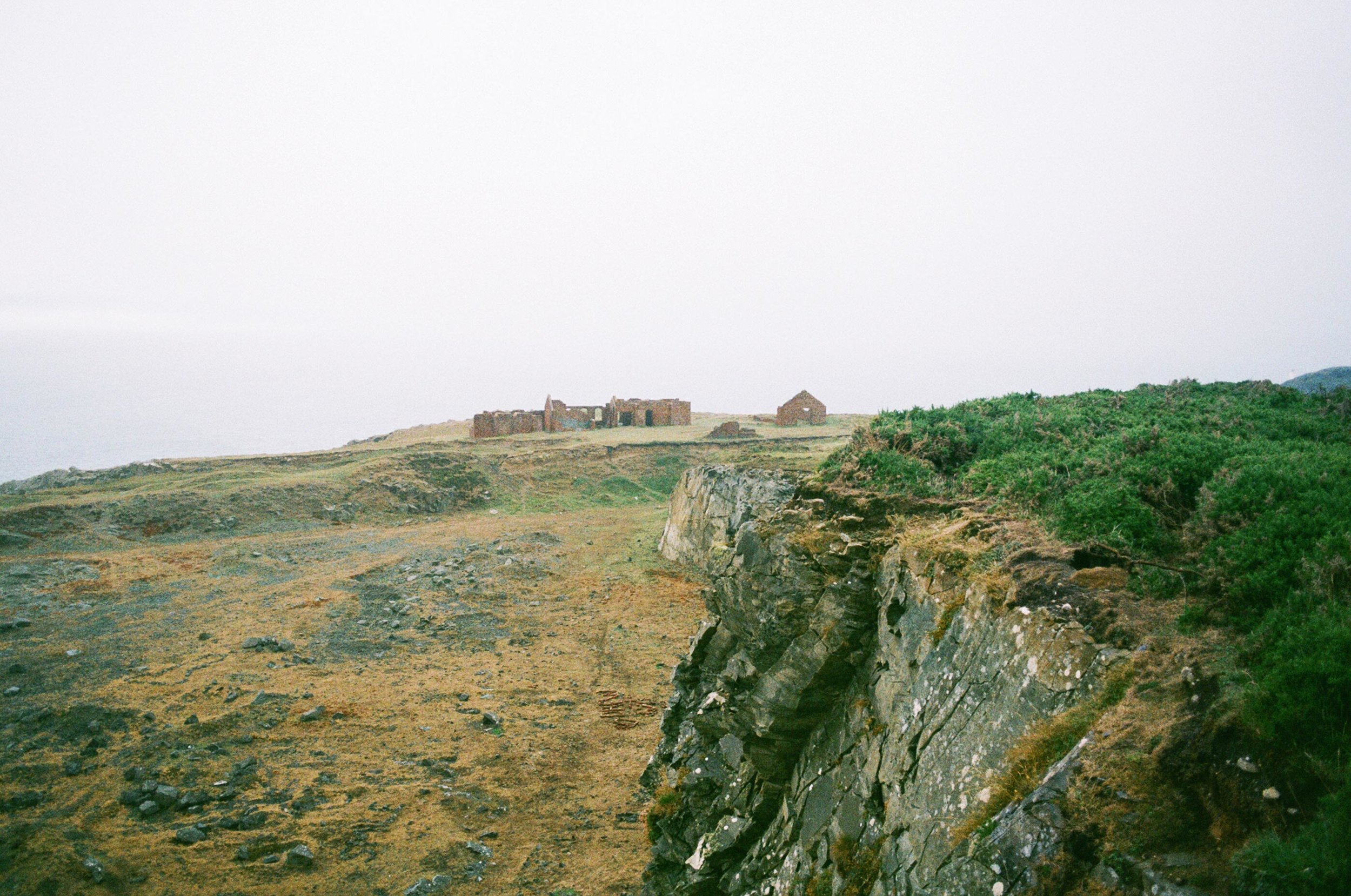
Before reaching the car park, you pass a track on the right that leads to Flimston chapel. This unusually shaped little chapel surprisingly dates back to medieval times and is one of the few surviving buildings left on the ranges. After falling into disuse the chapel was converted in 1787 into a carpenter's shop and cart shed. It was then later restored by a colonel and his wife in memory of their sons killed at war. Memorials of the family can be found both inside and outside in the churchyard. The chapel fell into disuse again after the Second World War but was rescued in the 1960s by the Royal Armoured Corps. Despite its medieval roots, the Army destroyed the neighbouring Flimston farmhouse in the 70s. The interesting ruins of which can be explored by climbing over a gate just by the chapel.
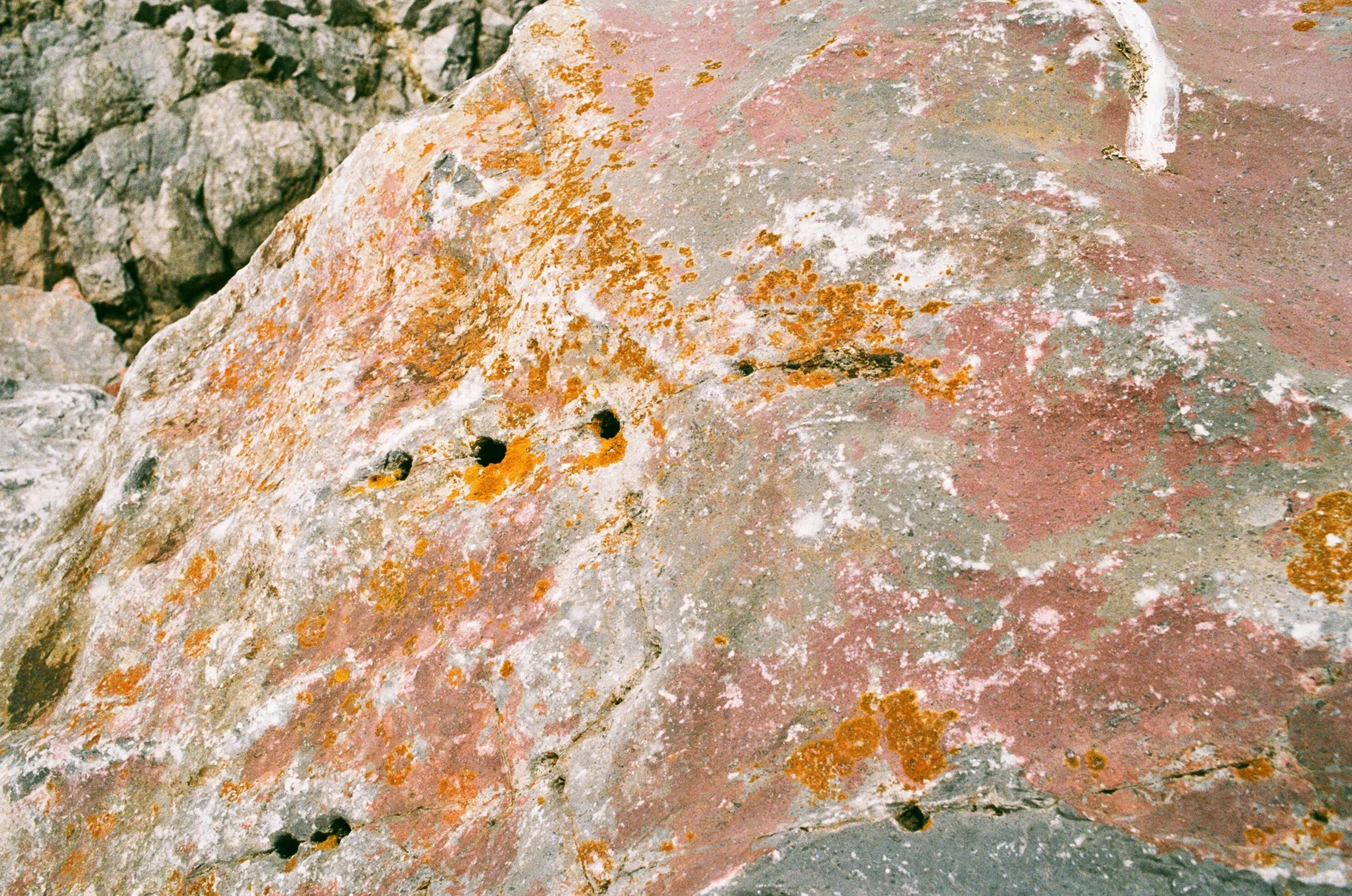
We noticed several odd large rocks dotted around the churchyard. I’ve since read that these are known as Glacial Erratics; pieces of rock picked up and moved around by glaciers, not belonging to the Geology in which they are planted and therefore recording another place. The word erratics comes from the Latin errare: to wander, to roam, to be mistaken or to go astray. In this case, they would have been carried afield from the north-west by the ice of the Irish Sea Glacier. After ending up on the Welsh coast, they have then been taken from their resting place to mark the graves of those buried at this little chapel in the middle of the ranges. Along with their layered histories, the chapel, ruins and erratics each merge with the landscape, yet somehow manage to stand out from it at the same time.
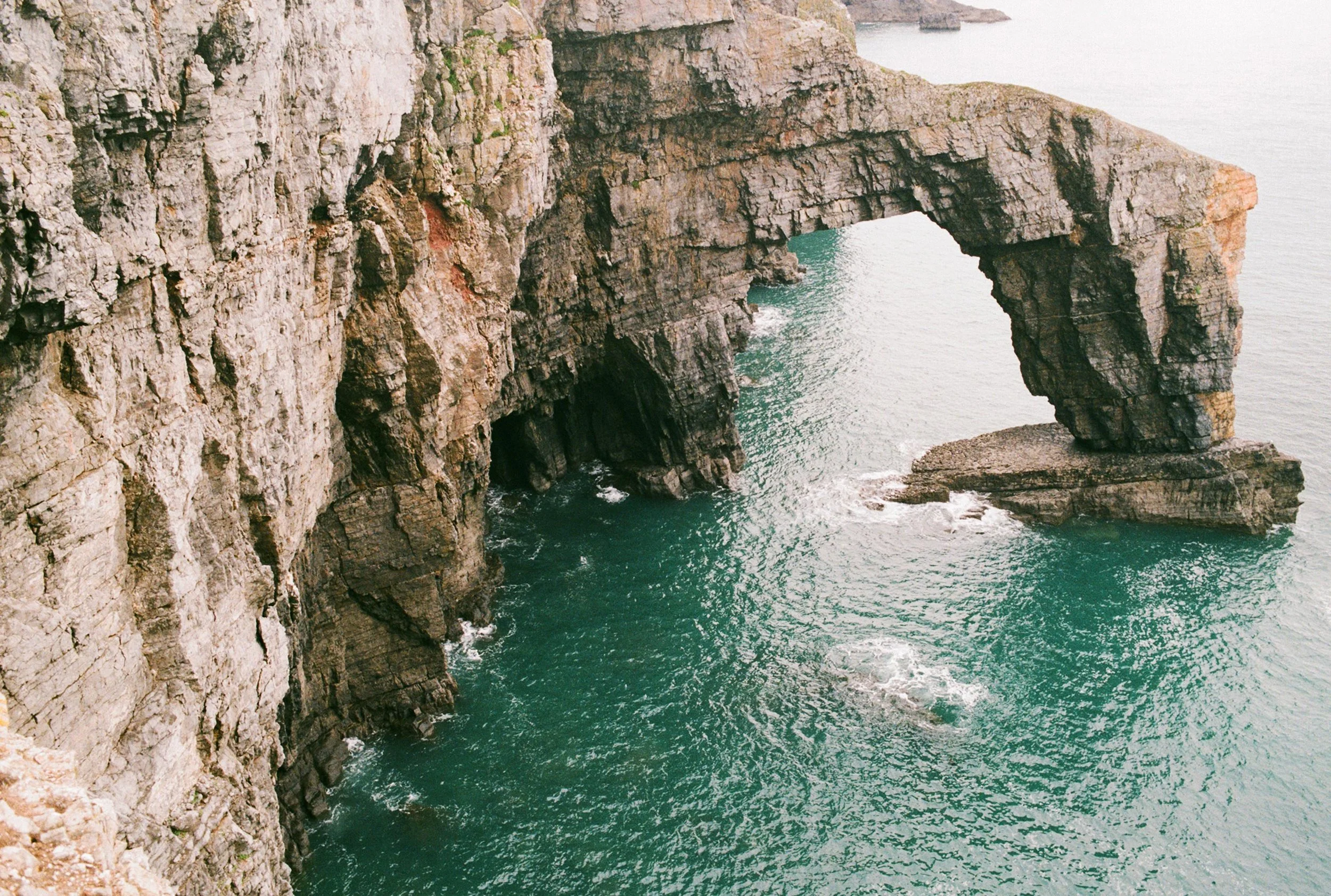
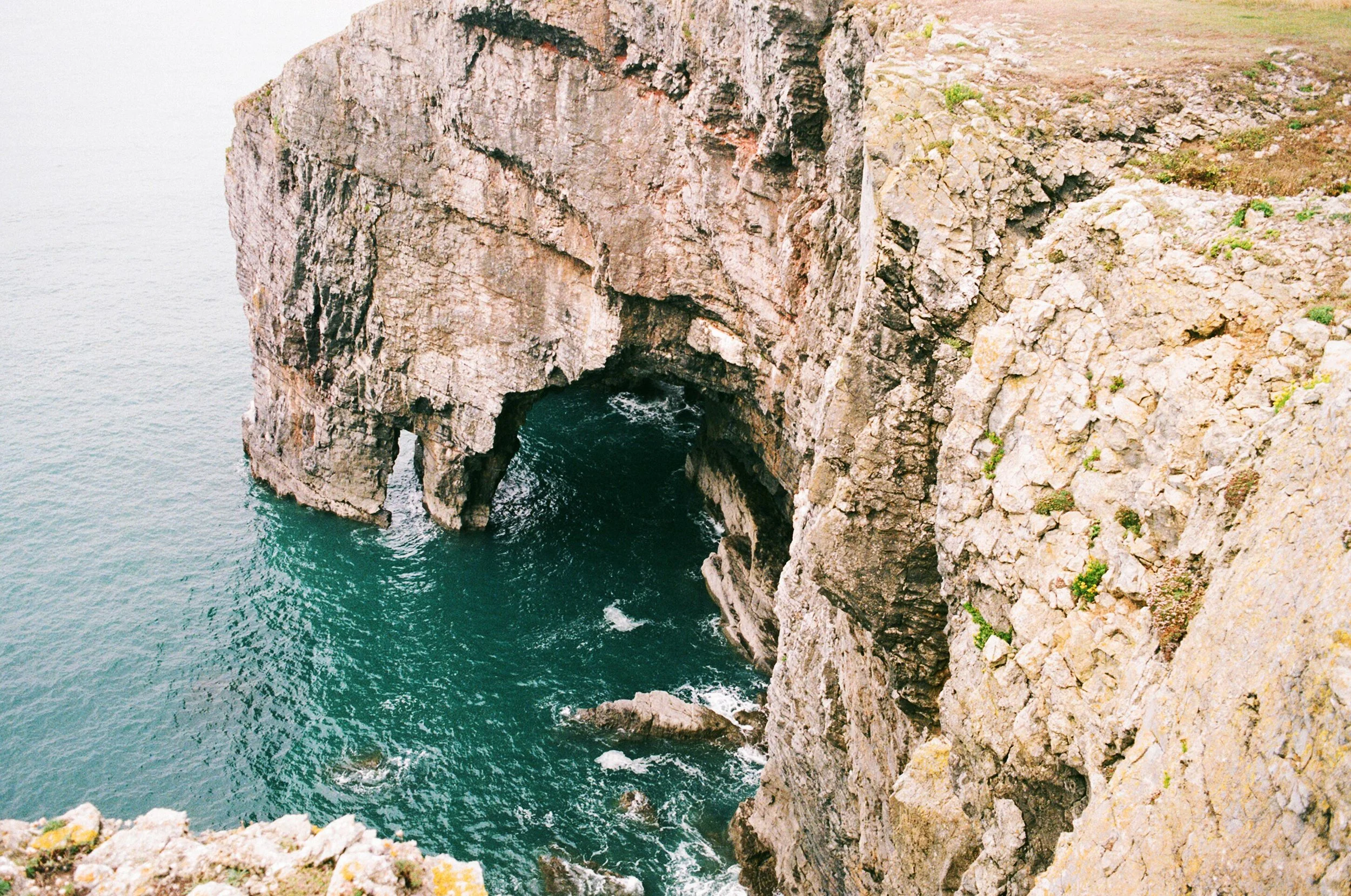
The car park is a short distance driving back down the military track. From here the viewing platform of the Green Bridge of Wales is only a 5 minute walk. Pembrokeshire is known for its rock formations and this one lives up to its claim of being one of the most dramatic. The sea arch is roughly 80 feet high, 70 feet wide and topped with rich vegetation, lending it its name. We spotted a couple of seals here basking in the cove below, brave sheep grazing on the cliff top edges and crying seabirds searching for their homes amongst the rocks.
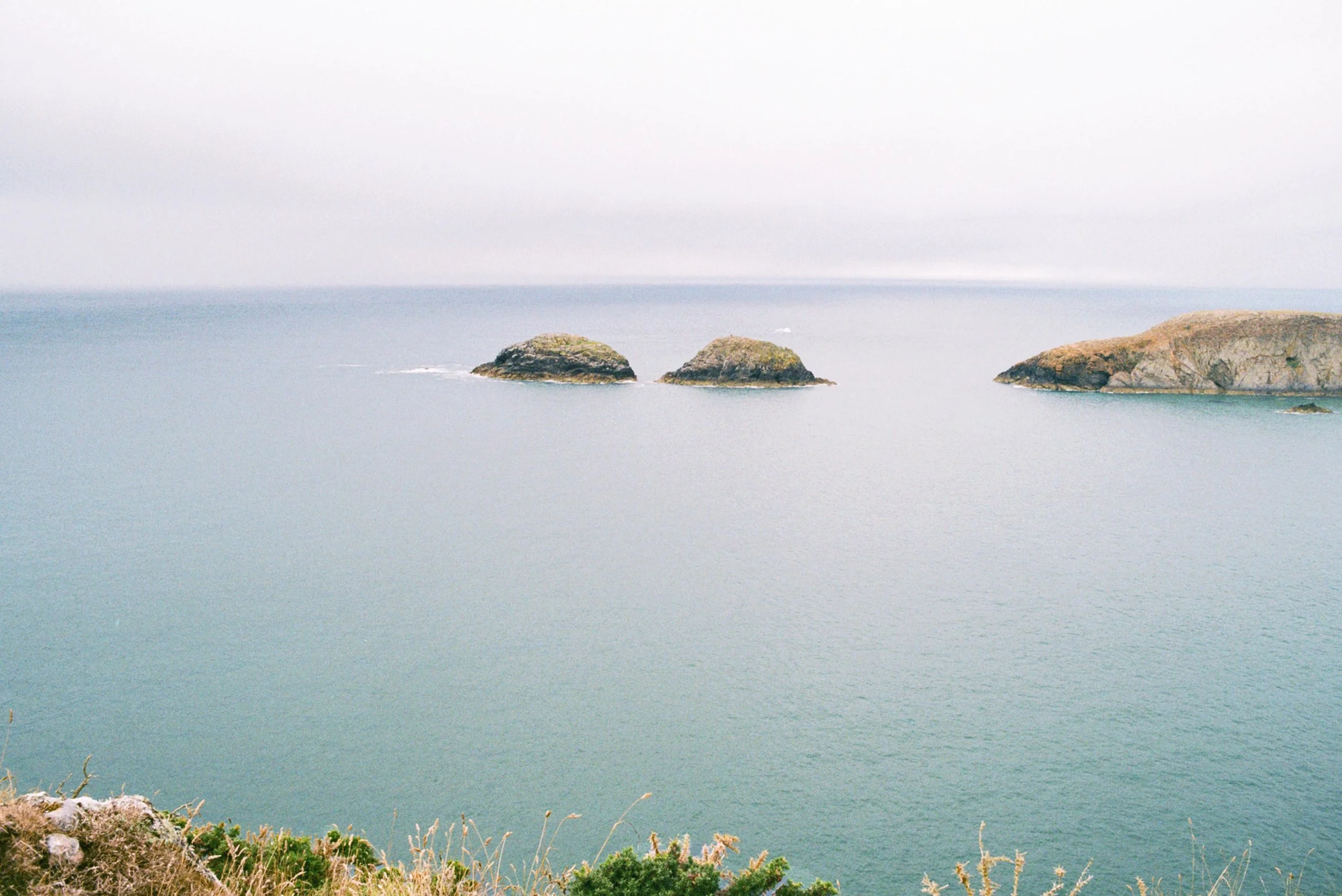
Over time the arch will erode and collapse, leaving behind a sea stack like the neighbouring Elegug stacks, a short walk east. The sea bird smothered pillars rightly take their name from the Welsh term for the guillemots that nest on them. These are sea stacks that tell a story. Comparing them with the Green Bridge forms a truly fascinating before and after picture of the effects of coastal erosion.

Continuing east we walked passed a blow hole known as the Cauldron and on to the site where an Iron Age fort once stood above Flimston Bay. Here colonies of bright yellow lichens and wild flowers grow in abundance on the rocks. A commemorative plaque in memory of a young soldier who fell to his death in 1990 also looks over this beautiful private beach, accessible via a difficult but very rewarding scramble down. If you are feeling energetic you can also extend the walk to take in St Govan's Chapel (below).
SAINT GOVAN’S CHAPEL & BOSHERSTON'S LILY PONDS
This is a circular walk that takes you from the village of Bosherton to the wonderfully storied Saint Govan’s Chapel, passing through Bosherton’s Lily Ponds and the Stackpole Estate.
We started at our campsite by Broad Haven South and walked the coastal path to St Govan's Head. On route you can stop at a quiet, twisting and sandy inlet called New Quay, known locally as Tank Beach. Walking on, it becomes apparent that this area was once a critical location for Second World War defences as you pass the old clifftop gun turrets and sentry posts that remain here. About ½ mile on after watching climbers scaling the limestone cliffs, we reached a flight of steps leading down to Saint Govan’s Chapel. The chapel is shrouded in legend beginning with these uneven stone steps, polished smooth by generations of visitors. It is said that when counting them you never reach the same total.
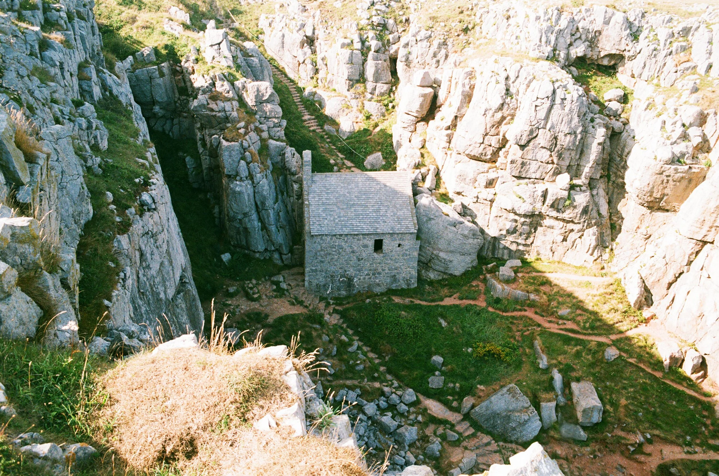
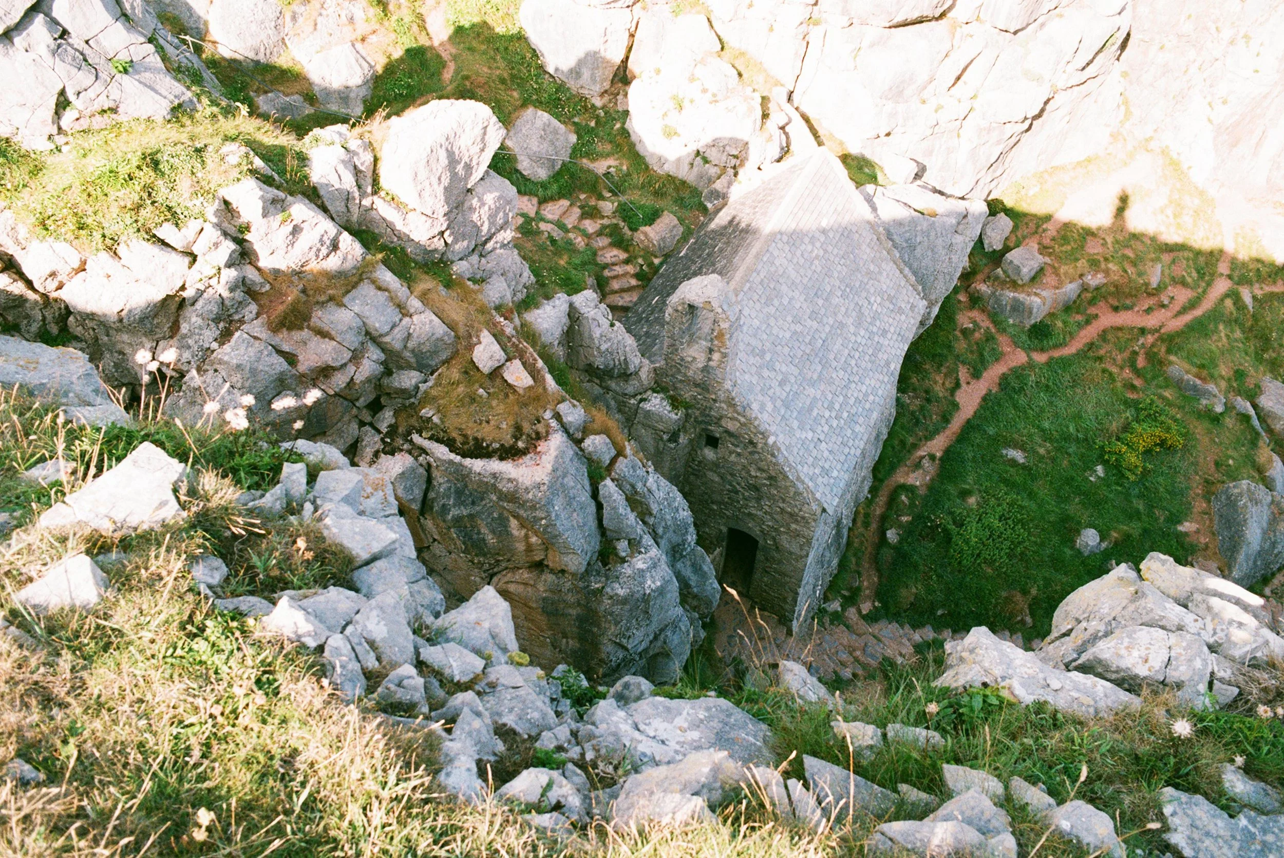
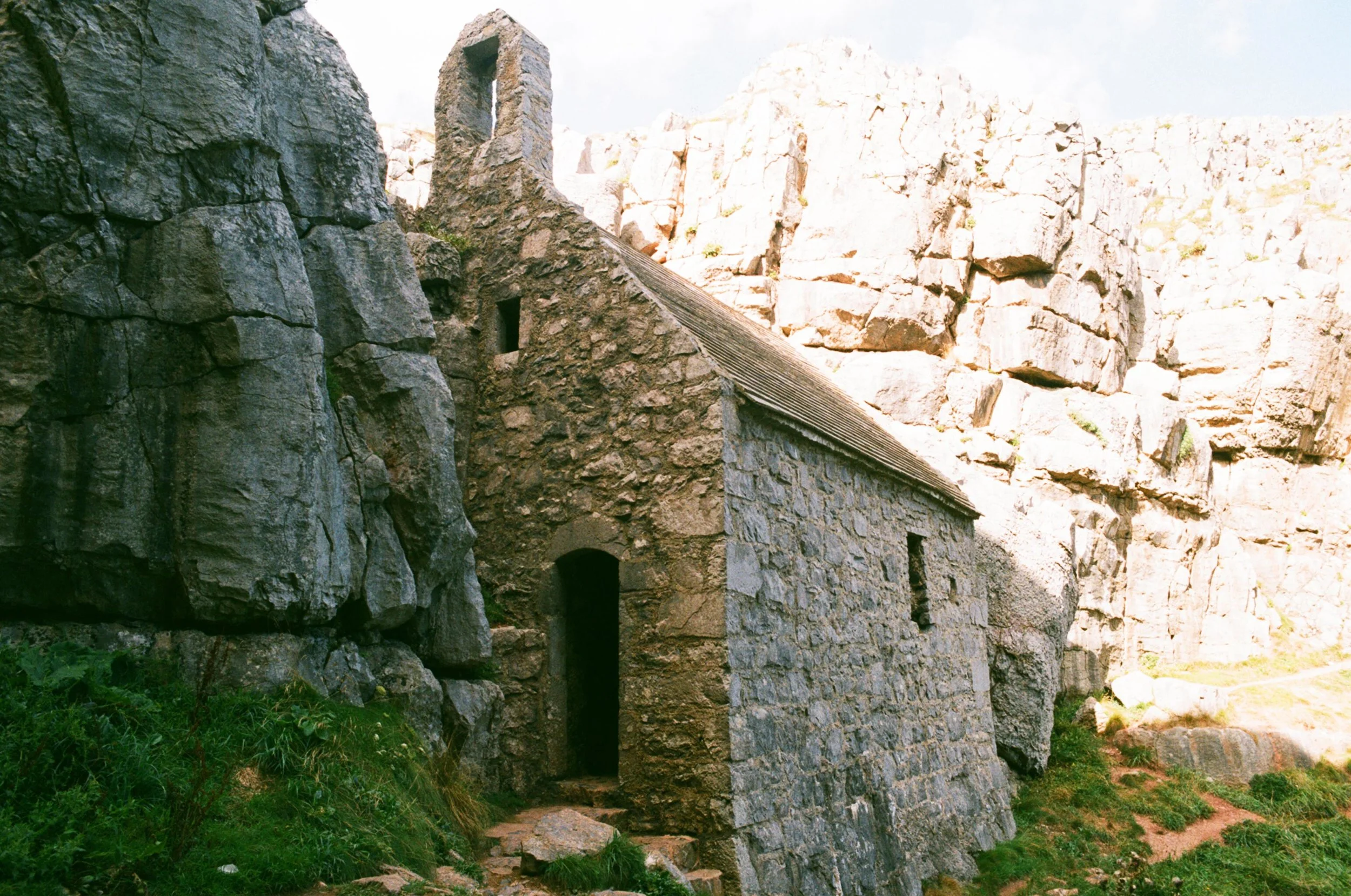
Tucked away in a cleft in the rocks, the chapel is carved out of the cliffs that it sits so perfectly between. It is a place that takes you back in history to a time of pirates and smugglers, marking the site where St Govan, a 6th century hermit, chose to live an isolated religious life. Govan died in 586AD and is said to be buried here under an ancient stone altar by the cave where he lived.
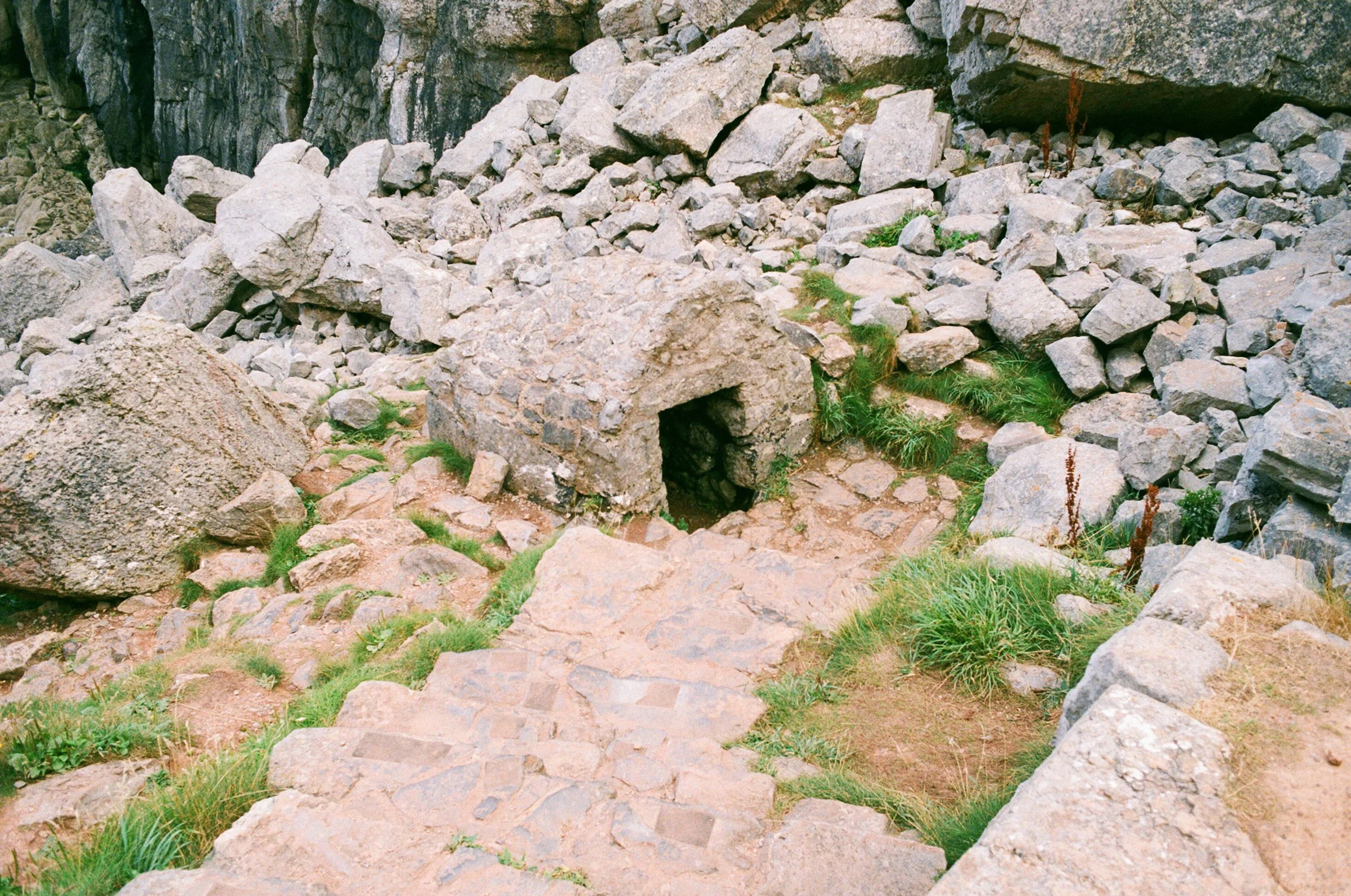
In medieval times it became a place of pilgrimage, with a holy well whose water was said to have healing qualities. The original cell was then rebuilt as a chapel in the 13th century, what we see today. It is a small chamber with a vaulted roof, the ancient stone alter, low stone benches and an empty bell-cote window, framing the view out across the ocean. As you enter the chapel, you can just make out the symbol of a fish carved many centuries ago beside the doorframe. A narrow rectangle in the floor marks the famous holy well, now long dry. Those seeking a cure would scoop up water here with a limpet shell to drink from, or to mix it with red clay from the surrounding cliffs to form a medicament. An arched doorway leads down to a rocky inlet where a second well can also be found, still retaining its stone canopy. I have read that as recently as the 19th century it wasn’t unusual to see a pile of crutches left on the alter or leant against the well outside.
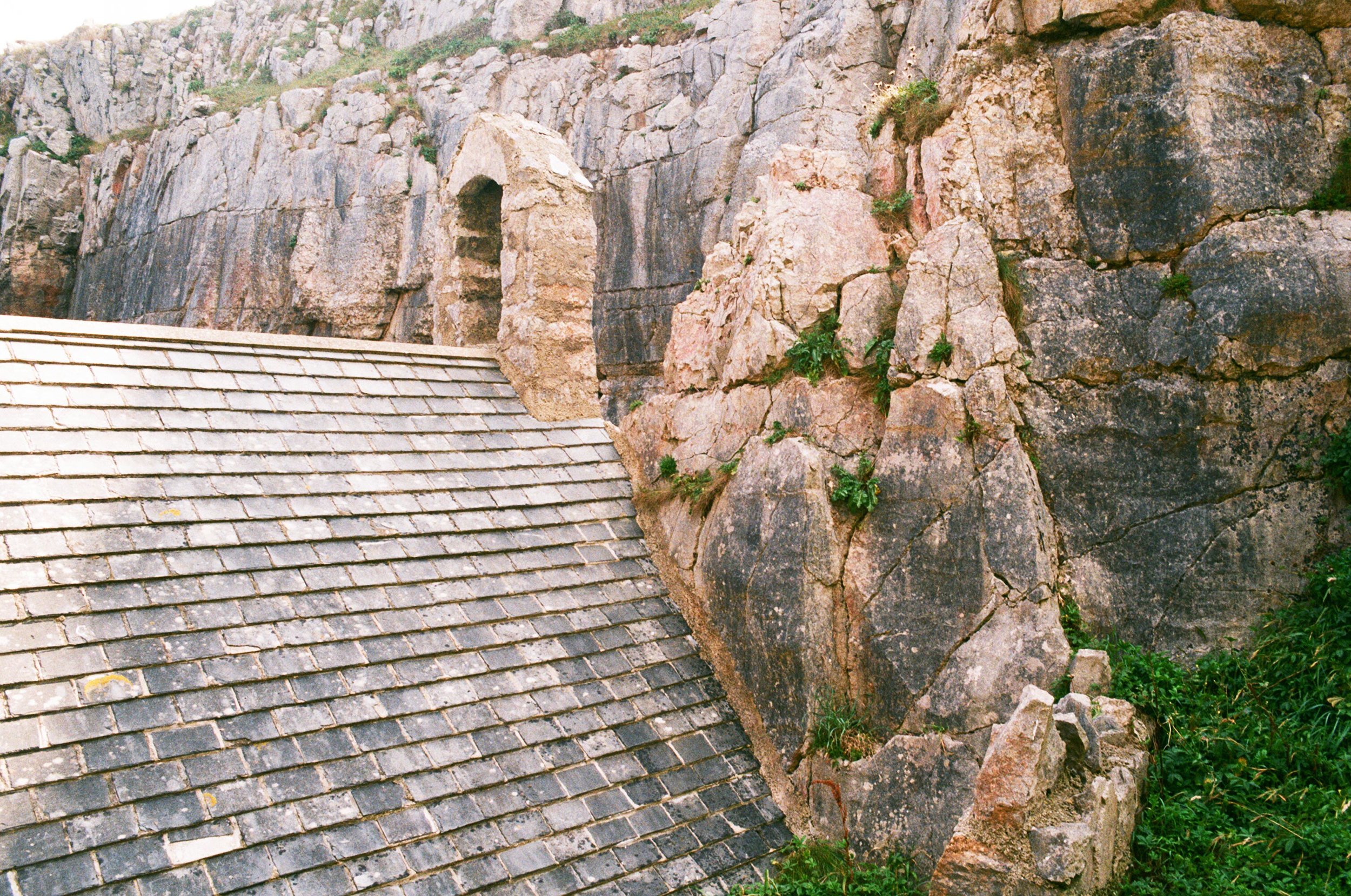
Behind the chapel’s alter is a narrow crevice with rib-like markings on the rock face. These are said to mark the spot where St Govan took refuge from a group of pirates who landed in the cove below, intending to steal a silver bell they had spied the saint using in daily prayer. The story goes that Govan spotted the approaching ship and squeezed himself into the crevice, praying not to be found. Miraculously, the rock closed protectively around him, having born the imprint of his ribs ever since. It is said that if you fit into the crack and turn round three times without touching the walls you will be granted a wish. The pirates didn’t find St Govan but they did loot all he had, stealing the silver bell. There are different versions of the story, one telling of a mighty storm that then sank the pirate ship. The bell was lost with it but can allegedly still be heard chiming during wild weather. Legends also say that the bell rings out if a stone by the outside well is tapped. I can’t say I didn’t try! The rise and fall of the sea below certainly seemed to send vibrations chiming across the rocks.

It is a truly magical place and for much of our time there, we had it more or less to ourselves. This added to there being something in the air and I couldn’t help but picture a man living in such a lonely but beautiful place on the edge of the land.
An extract from an old poem by A.G. Prys –Jones (1888-1987):

St Govan, he built him a cell
Between the wild sky and the sea,
Where the sunsets redden the rolling swell
And brooding splendour has thrown her spell
On valley and moorland lea.
St Govan still lies in his cell,
But his soul, long since, is free,
And one may wonder - and who can tell -
If good St Govan likes Heaven as well
As his cell by that sounding sea?
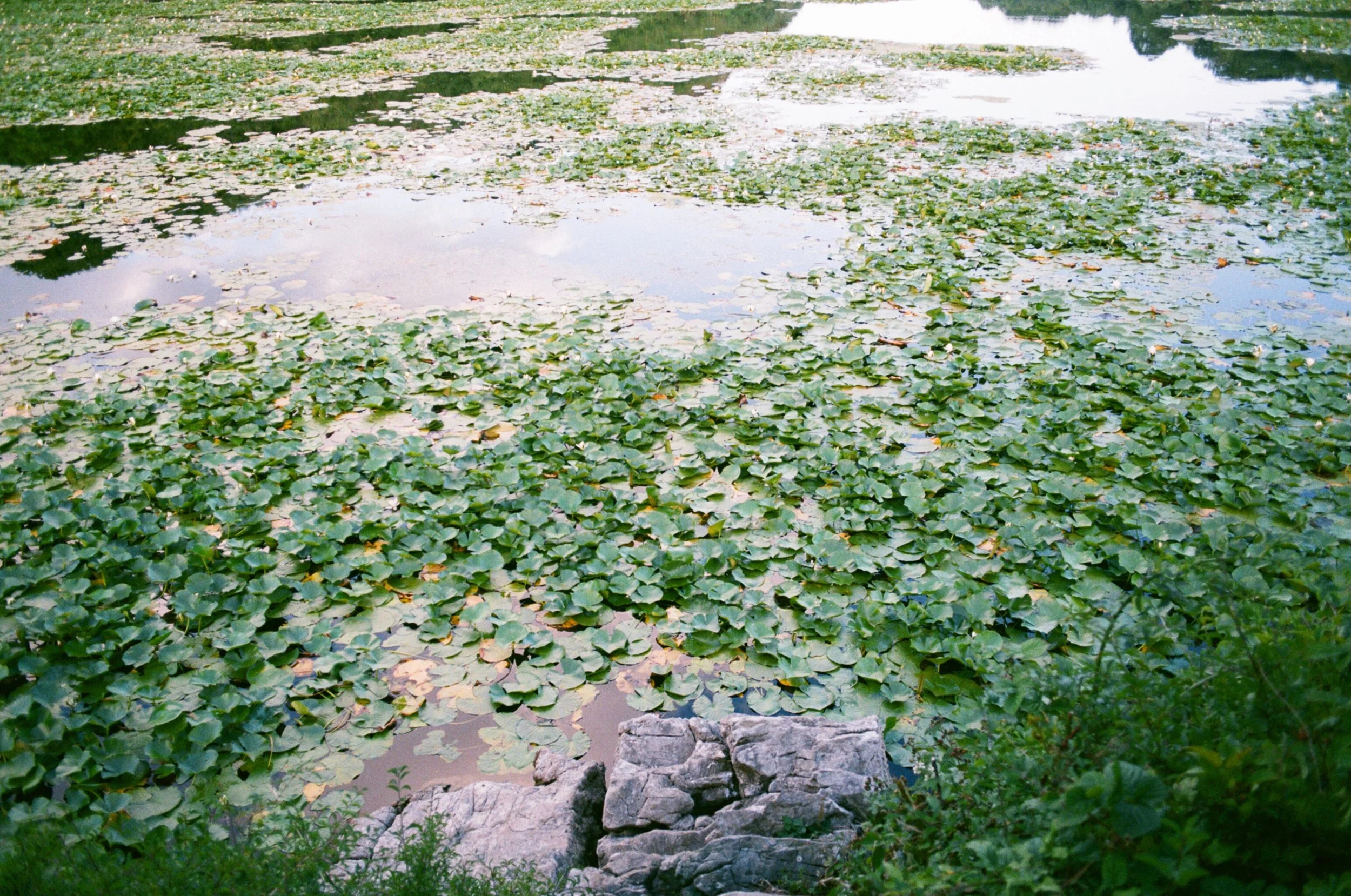
After spending some time exploring the chapel and the rocky cove below, we followed a country lane inland to Bosherston village, with its pretty cottages, pub and Norman church. The ivy clad tea rooms, Ye Olde Worlde Café, is a good place to stop for a slice of home-made cake sitting on tables in the front garden, before making your way to the famous lily ponds. The ponds are vast, blanketed with large lily pads jostling for space, and home to resident otters, like something straight out of a children’s book.
From here you can take various footpaths to see more of Stackpole, walk up to the Eight-Arch Bridge, on to Stack Pole Quay or Barafundle Bay. We headed back alongside the Lakes until they met the edge of the sand dunes and reduce to a small stream, running into the sea at Broad Haven.